

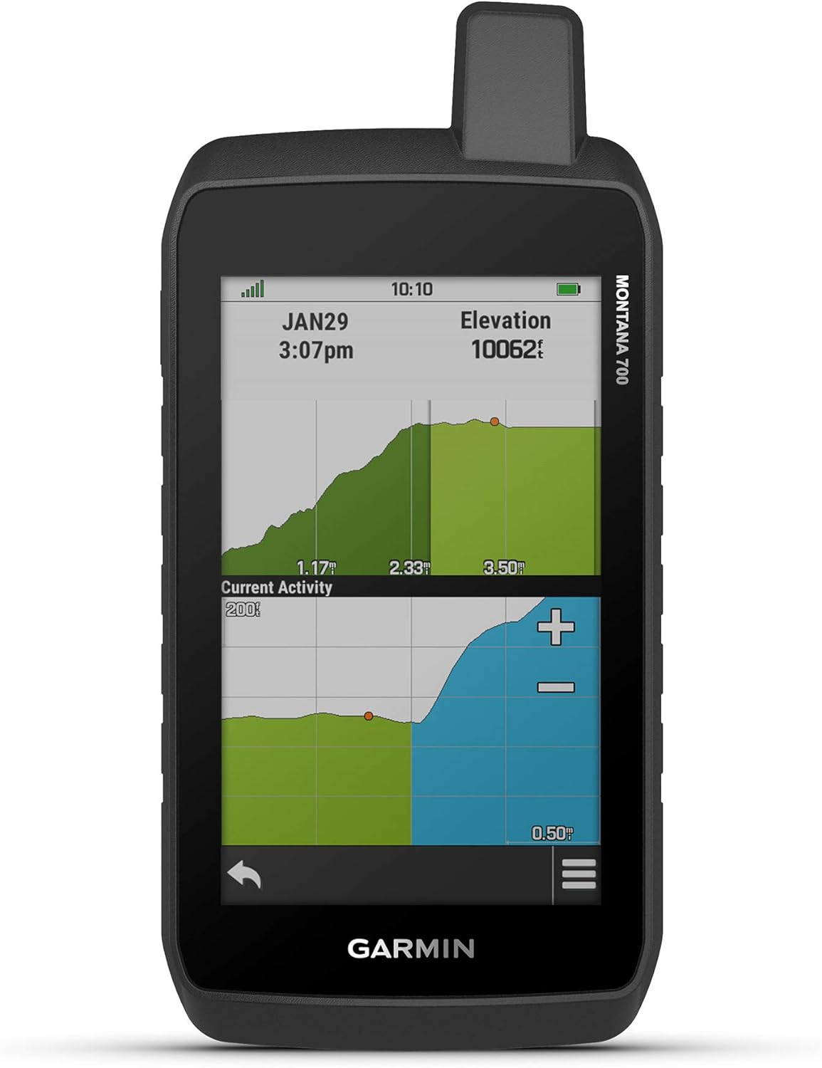


Garmin Montana 700, Rugged GPS Handheld, Routable Mapping for Roads and Trails, Glove-Friendly 5" Color Touchscreen
- Category: Handheld GPS Units
- Store: Garmin
Share on:
Description
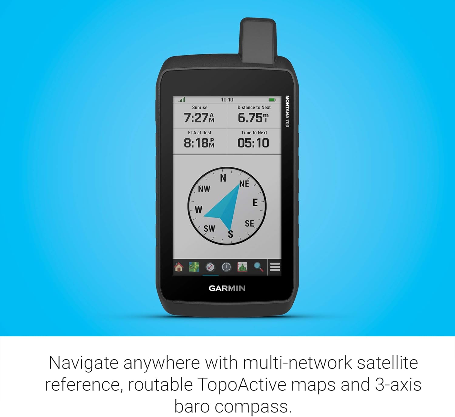
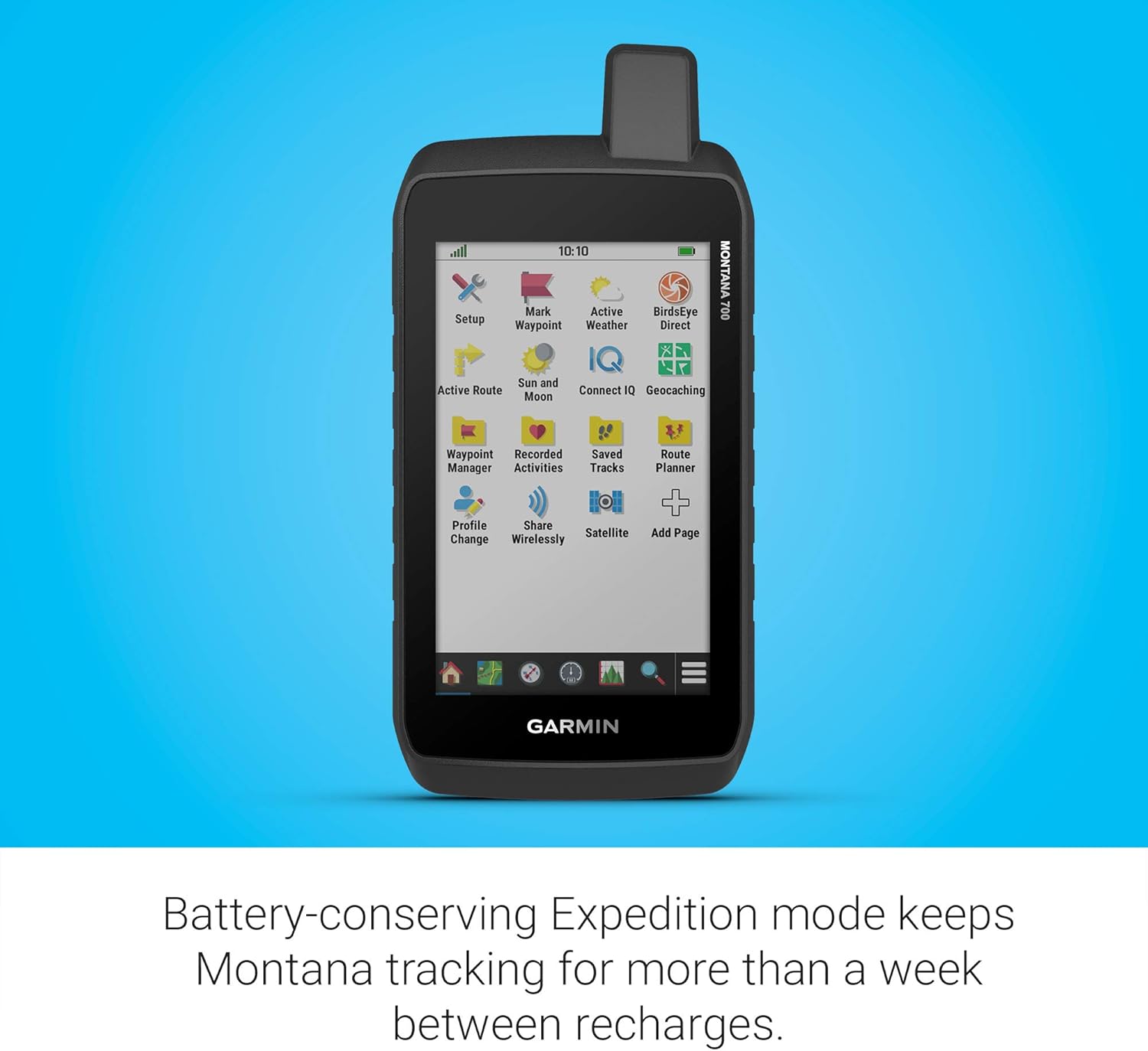
Track your adventures on any terrain. This durable, water-resistant handheld is tested to U.S. military standards and features a glove-friendly 5” touchscreen that’s 50% larger than previous Montana models. To navigate your adventures, use preloaded topographical maps for the U.S. and Canada. View terrain contours, elevations, coastlines, rivers, landmarks and more. Optional display of federal public land boundaries on topographical maps helps you know that you’re venturing where you’re supposed to be. Use direct-to-device downloads of BirdsEye Satellite Imagery (no annual subscription required) to see photo-realistic views and create waypoints based on landmarks. Navigate your next trail with ABC sensors, including an altimeter for elevation data, barometer to monitor weather and 3-axis electronic compass. Use cellular connectivity (when paired to a compatible smartphone) to access up-to-date Active Weather forecasts through the Garmin Connect app. Take it hiking. Take it hunting. Take it off-grid. Montana 700 is for outdoor enthusiasts who want a rugged, versatile GPS handheld with routable mapping for roads and trails. Its glove-friendly 5” color touchscreen is 50% larger than earlier models. Multi-GNSS support, ABC sensors and preloaded TopoActive maps provide all the on- or off-road capability you’d want for navigation on foot, bike, kayak, ATV and more. Wireless pro-connectivity gives you direct-to-device BirdsEye Satellite Imagery downloads, location sharing, Connect IQ app support and more. Extend battery life for more than a week with the new ultralow-powered Expedition mode. For hunters and trainers, the IPX7-rated unit syncs with compatible Astro or Alpha series handhelds (sold separately) to help track sporting dogs in the field.
Product Overview
We Recommend